Day 12.
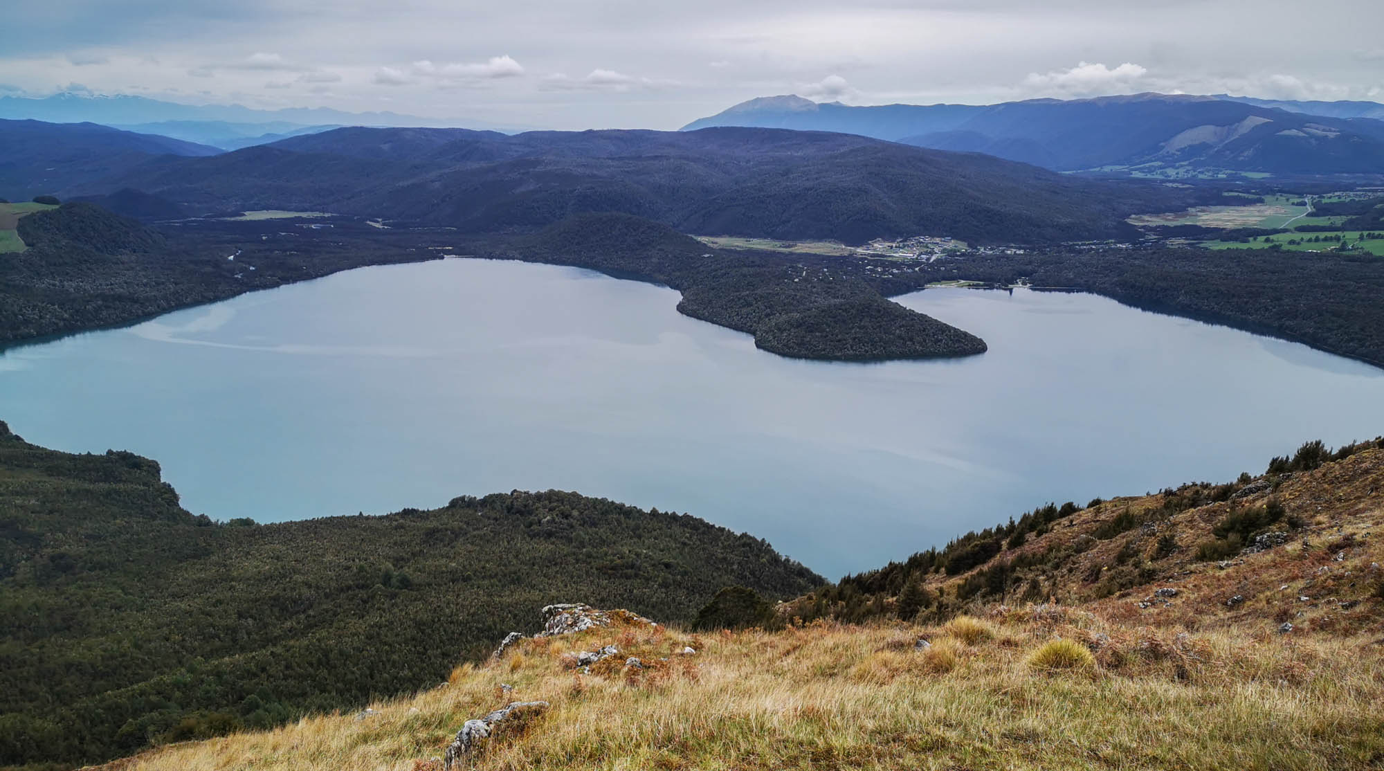
The detour works fine and is on pave road. I have a stop at the i-Site in Saint Arnaud – although I’m quite good prepared it’s always nice to stop by and get a short briefing and most updated information. I plan to do the loop of the two treks Patty and Pinchgut. I drive along Mount Robert Road to a car park and realize that this is where the Patty trek starts – fine, it’s longer but not as steep ascent to the summit. The trek starts in forest, but quickly becomes more open so I can see lake Rotoiti and the surrounding mountains – this is much more my style compared to Abel Tasman. The summit is in 1421 m height (but didn’t get the altitude of the car park where I started) – it takes close to two hours, because I have a stop to talk with a guy from Texas, who has recently been engaged to a Kiwi (native from New Zealand) and they have slept in a hut last night. The views are nice and no steep sides to be cautious about. The decent should be much steeper, and it really is – I need to hold on to small trees in the decent and can not understand why the path is not more clear. After some minutes I realize that something is wrong, and now I’m in the middle of a small birch tree forest (at least white bark). On MapsMe I can see the track, and that I’m supposedly ~30m off the official route – I make my way through and find the path – really nice with such detailed maps and GPS with compass direction! The decent is rather quick (utilizing walking poles to reduce knee strain) and after 3 hours I’m back at the car. It’s a short but recommendable loop.
I get my lunch down at the Nelson Lake, with view over the calm water. There is a person who parks his offroad motorbike on the bridge to get a nice photo of the bike, lake and mountains in the background. I ask if I should help take a photo with him included, and he’s happy to get such (and I then get to try a Nikon D750 with the nice 70-200mm f2.8 lens – I’m myself a Nikon person, but the equipment is all too heavy for such treks, so now it’s with the Huawei in my pocket).
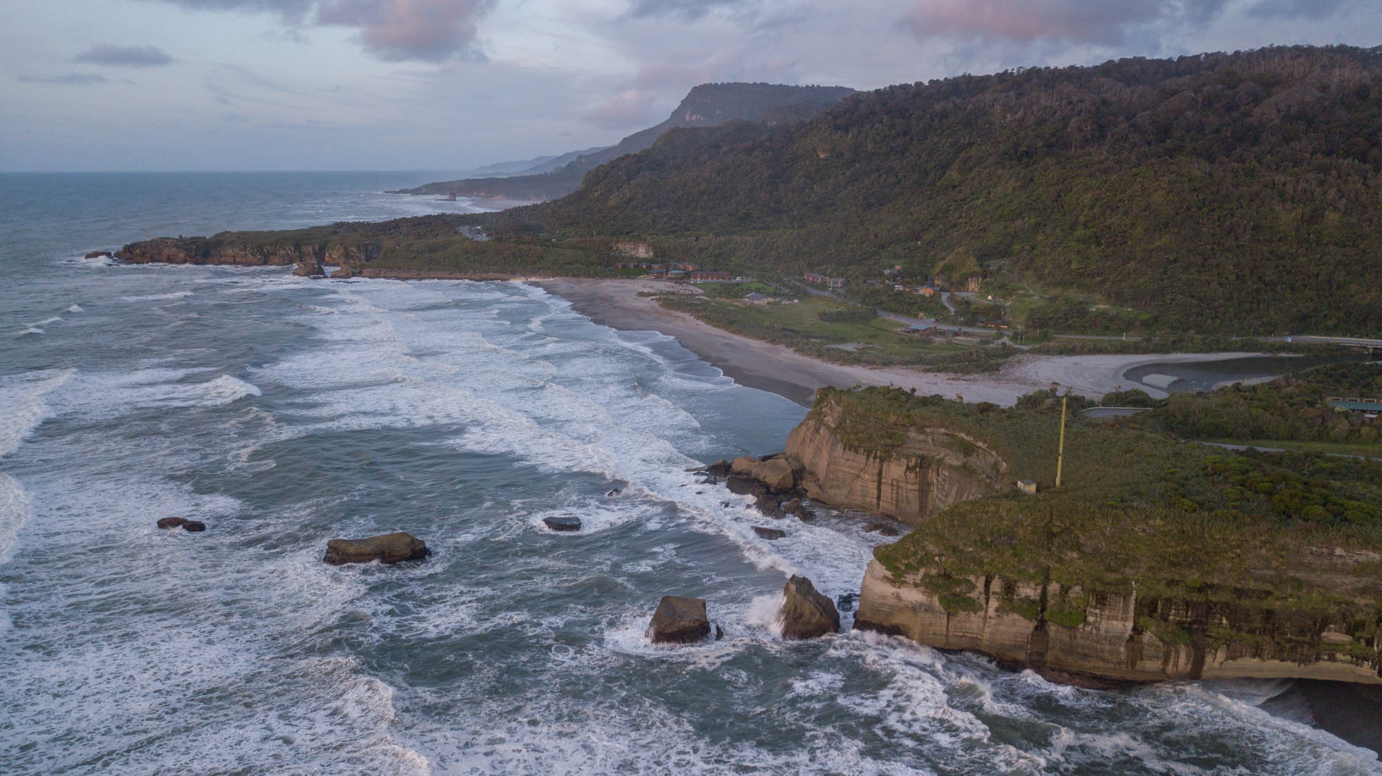
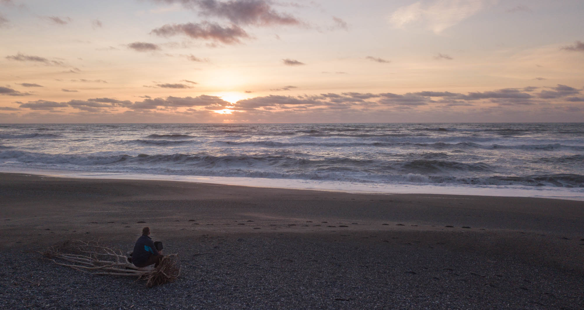
I drive to Punakaiki, which is a long drive and takes close to 3 hours with the stops for taking photos. There are not many places made for taking photos. Often the picnic places do not have a good view, and even when a place is marked and signed with a Camera, it’s not always a good view. The tour is for a large part along a river, and later mountains covered in trees and bushes – I do prefer the view where the mountains/hills are also covered in grass. The last part brings me to the west coast and rather spectacular views driving high above the see and can see how waves hit the shore and the many cliffs. I park at a Freedom camp site just south of Punakaiki, where I can see and hear the waves from the camper. For sunset I find a nice place on the beach and go for a short flight – in the background one can notice the pancake rocks which I’m going to see tomorrow.
If there is anything you would like me to write about then you can contact me on:
You can also post a comment – it will not go official before I approve it.